Research & Evidence
This page contains supporting material used to understand the structure, behaviour, and context of the site.
All information is presented as reference material and observational evidence.
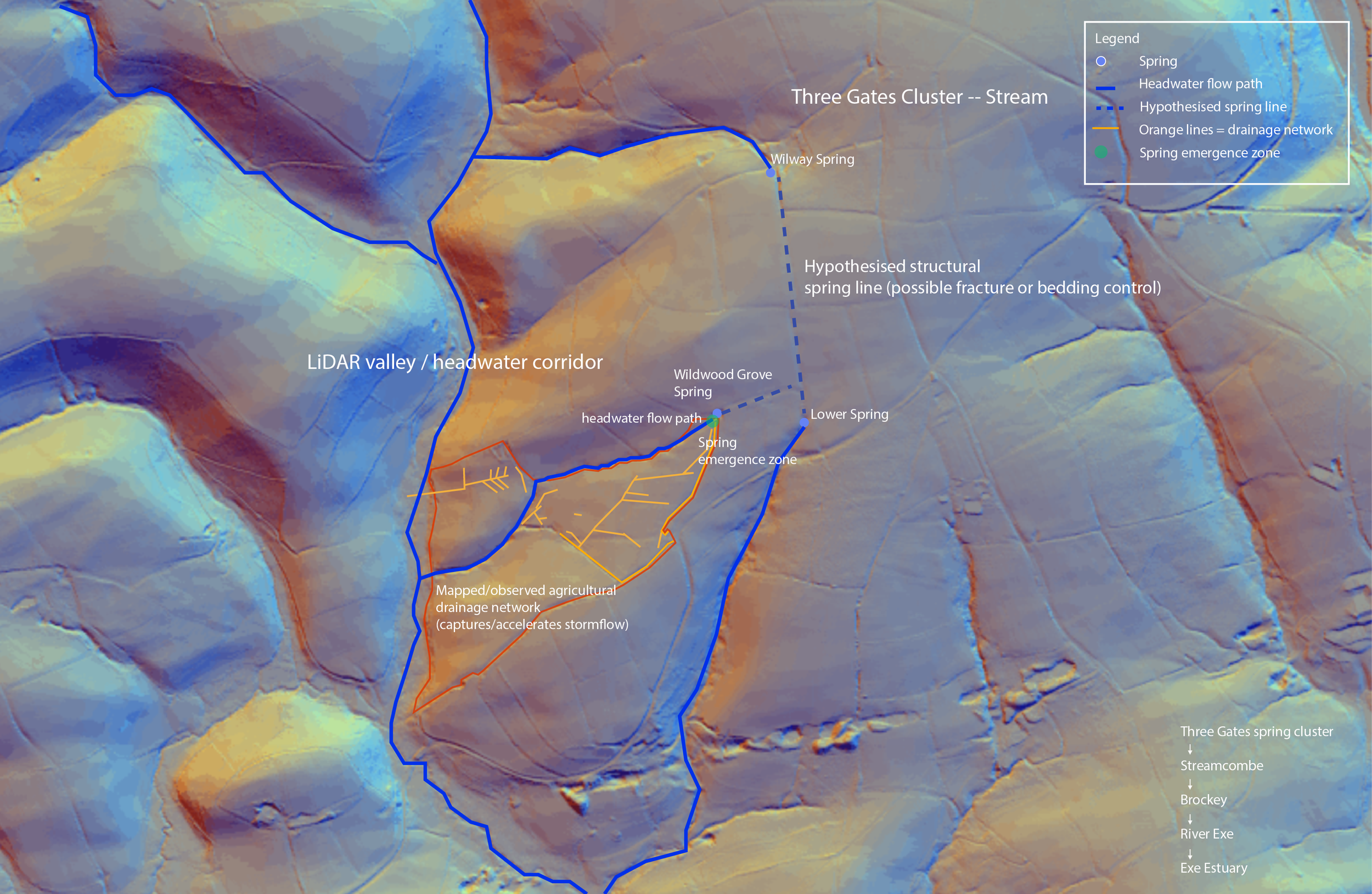
Site structure
The structure of the site is defined by a headwater valley system, with aligned spring emergence points and a connected flow path.
This can be observed through LiDAR data, which reveals the underlying landform and the pathways through which water moves across the site.
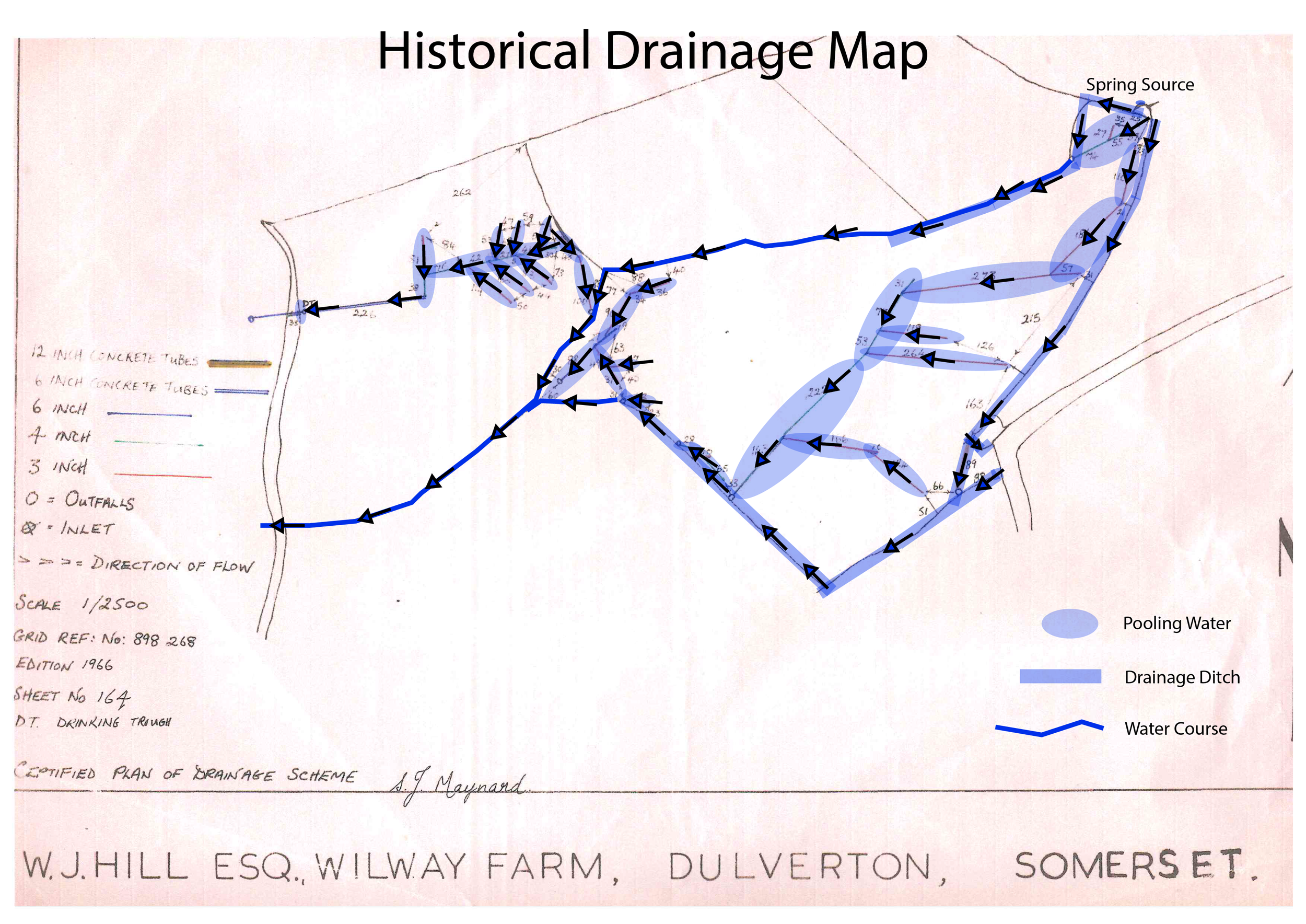
Historical context
Historical mapping shows that the site has been subject to agricultural drainage.
This includes a network of installed pipes and channels designed to alter the natural movement and storage of water within the land.
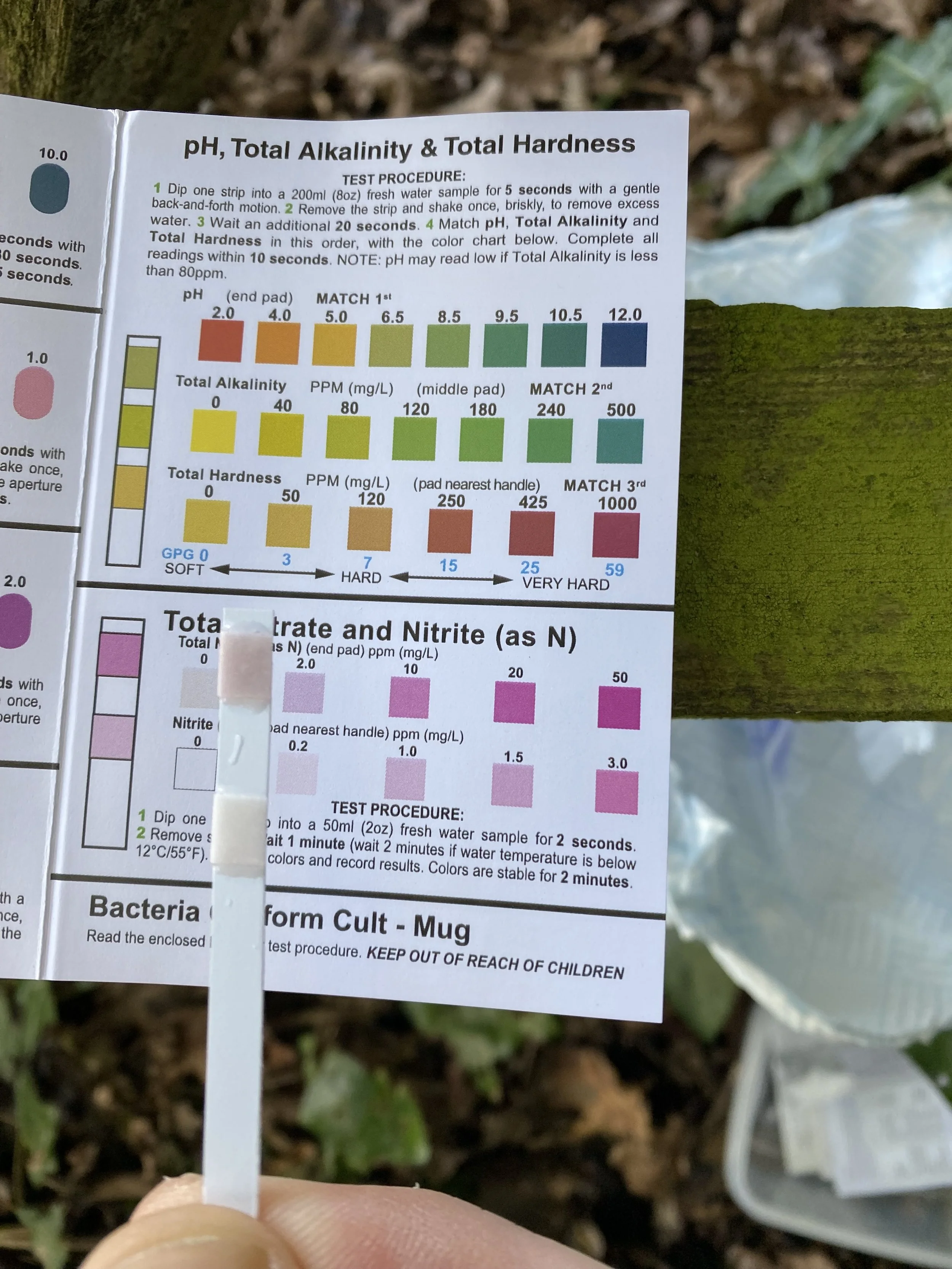
Field observations
Field observations include direct measurements of water, ground conditions, and biological activity.
These observations are recorded over time and form the basis of the site’s observational record.