
Evidence
This page brings together field observations, measured conditions, and supporting technical information to describe how the system at Wildwood Grove behaves.
Evidence is drawn from direct measurement, repeat observation, and external reporting.
Interpretation is applied within this page to identify consistent patterns and relationships, while remaining grounded in observed conditions rather than assumed outcomes.
Rainfall
Based on Met Office HadUK-Grid data (1991–2020), the site receives approximately 126.5 million litres of rainfall annually.
This rainfall represents the primary input to the system.
As a spring-fed headwater site within the upper River Exe catchment, the way this water moves through the land influences how it enters the wider river system.
Field observations show that rainfall is expressed across the site through a combination of groundwater emergence, surface flow, and movement through historic agricultural drainage pathways.
This volume of water moves through a relatively small headwater system, making the way it is conveyed across the site particularly significant.
Observed System Behaviour
Monitoring across the site records rainfall, water levels, ground moisture, and temperature at fixed locations.
When considered together, these measurements provide a consistent picture of how water moves through the landscape.
Water is observed emerging at the spring and forming a defined headwater channel, which continues through the site before leaving downstream.
Across repeated observations, water remains present within the channel under varying conditions, including periods without recent rainfall.
Temperature measurements at the point of emergence remain relatively stable, with gradual change observed along the downstream flow path.
Historic agricultural drainage is visible across the site, including subsurface pipes and surface ditches.
Field observations show that these features intercept and redirect water, creating defined pathways through which water is conveyed downslope.
Observed Watercourse Behaviour Under Different Conditions
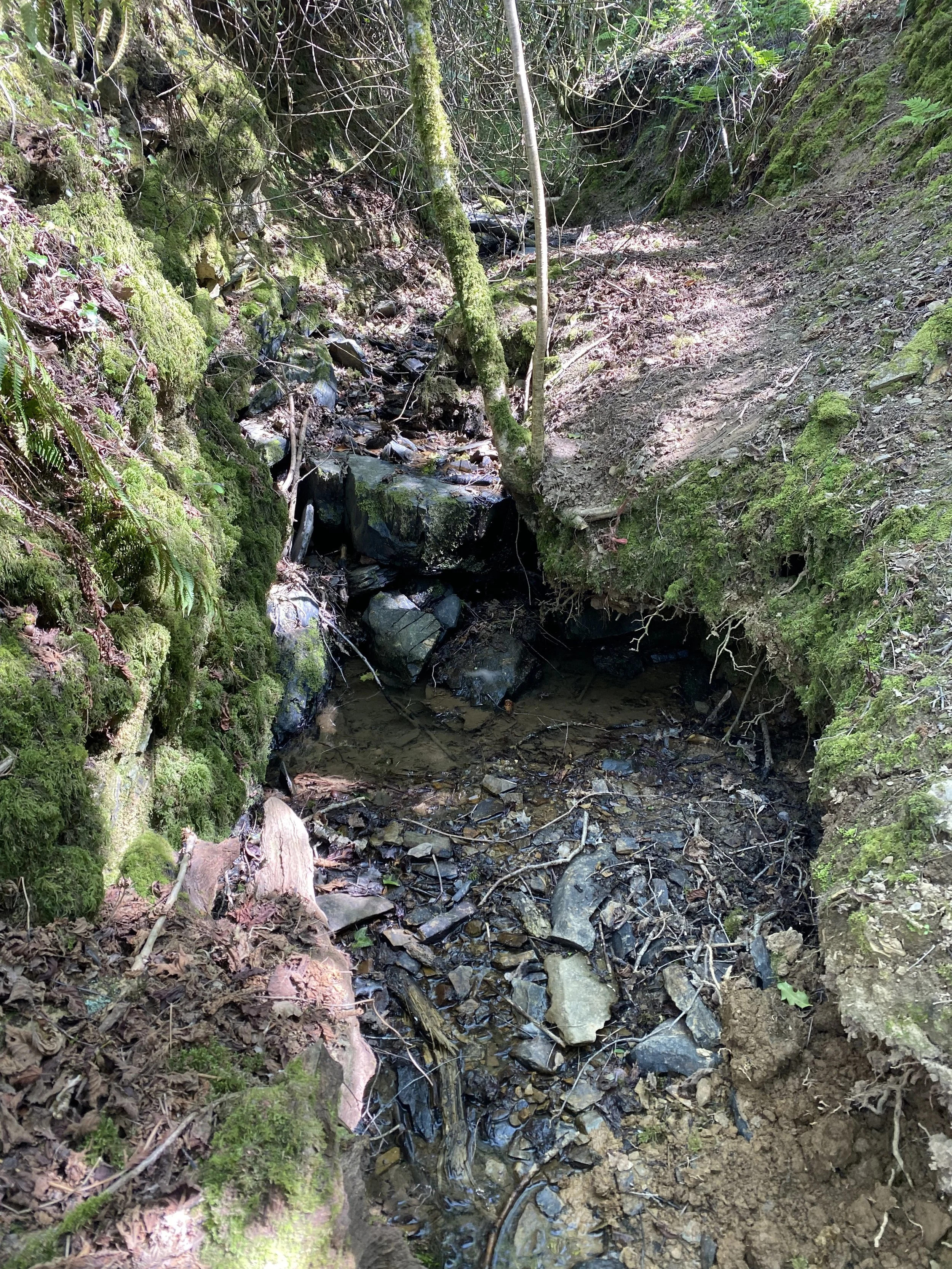
The behaviour of the watercourse changes visibly under different rainfall conditions.
Lower rainfall conditions
Under drier conditions, flow remains present within the channel, indicating continued water input to the system.
Higher rainfall conditions
Following rainfall events, increased flow is observed within the channel, with water moving rapidly through defined pathways associated with the drainage network.
These observations show that the system responds to rainfall while maintaining continuous flow through the headwater channel.
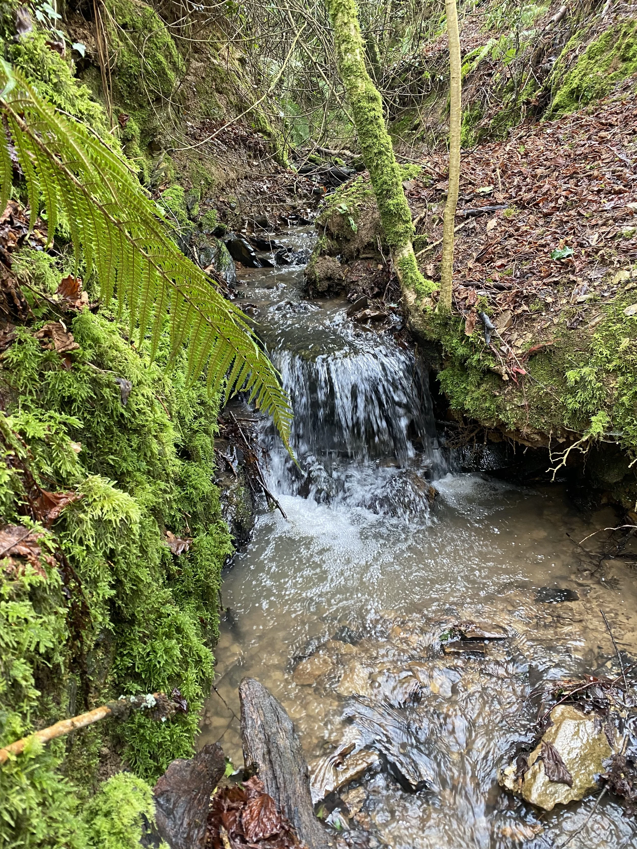
Comparison of watercourse conditions under higher rainfall periods, showing variation in flow through the same channel.
Comparison of watercourse conditions under lower rainfall periods, showing variation in flow through the same channel
Headwater and Downstream Context
Wildwood Grove is located within the headwaters of the River Exe catchment, with water moving from the site into the Brockey River and onward into the River Exe and Exe Estuary.
The Brockey River (Water Body ID: GB108045015080) is classified under the Water Framework Directive and faces challenges in achieving Good Ecological Status, with documented pressures including diffuse agricultural pollution and hydromorphological modification.
Further downstream, the River Exe catchment is characterised by:
Rapid runoff behaviour associated with upland rainfall and land drainage
Water quality pressures linked to sediment, nutrients, and agricultural land use
Ongoing regulatory focus under Water Framework Directive objectives and catchment-based management initiatives
Headwater systems influence how rainfall enters downstream rivers.
At this location, observations describe how water is introduced and conveyed into the wider catchment.
Technical Reports

Richard Green Ecology — Baseline Survey
The ecological baseline survey establishes the existing habitat condition across the site, identifying the land as predominantly modified grassland with associated features.
This provides a structured reference point for understanding the current ecological state of the site and its relationship to land use and management history.

River Restoration Centre — Opportunities Report
The River Restoration Centre report identifies the site as a spring-fed headwater system influenced by historic agricultural drainage.
It describes how water movement has been altered through drainage infrastructure and identifies a clear hydrological context in which natural processes are currently influenced by historic drainage infrastructure.

Geckoella — Geology and Soils Technical Note
The geology and soils report confirms that the site is underlain by Devonian sandstone with consistent silty loam soils across the landscape.
It identifies hydrology as the primary factor influencing how water is expressed across the site, noting that observed wet conditions and groundwater emergence occur despite soil classifications typically associated with freer drainage.
Evidence Approach
Evidence at Wildwood Grove is built through a combination of direct observation, fixed-location measurement, and supporting technical information.
Field measurements record conditions as they occur across the site, including rainfall, water levels, ground moisture, temperature, and water sampling.
These are taken at consistent locations to allow comparison over time and under varying environmental conditions.
Technical reports provide additional context across ecology, hydrology, geology, and soils.
Interpretation is applied by combining these sources to identify consistent patterns in system behaviour, while remaining grounded in recorded conditions rather than assumed outcomes.