
River Exe Catchment
How is Wildwood Grove connected to the wider River Exe catchment?
Evidence Sources
The information presented on this page is derived from:
Environment Agency Catchment Data Explorer
Environment Agency Exe Catchment Flood Management Plan
South West Water Exe Drainage and Wastewater Management Plan
Exe Estuary Management Partnership publications
Catchment Sensitive Farming / Headwaters of the Exe information
Site mapping and field observations at Wildwood Grove
Overview
Wildwood Grove is located within the upper headwaters of the River Exe catchment.
Water originating within the site enters the Streamcombe tributary system, flows into the River Brockey, then into the River Exe, before continuing downstream towards the Exe Estuary.
This places Wildwood Grove within the upstream part of a wider river system extending from Exmoor and the upper catchment to Exeter, Exmouth, Dawlish Warren and the Exe Estuary.
The Environment Agency identifies the River Exe as the major river system within the East Devon management catchment, with the Exe rising on Exmoor before flowing southwards to form the Exe Estuary.
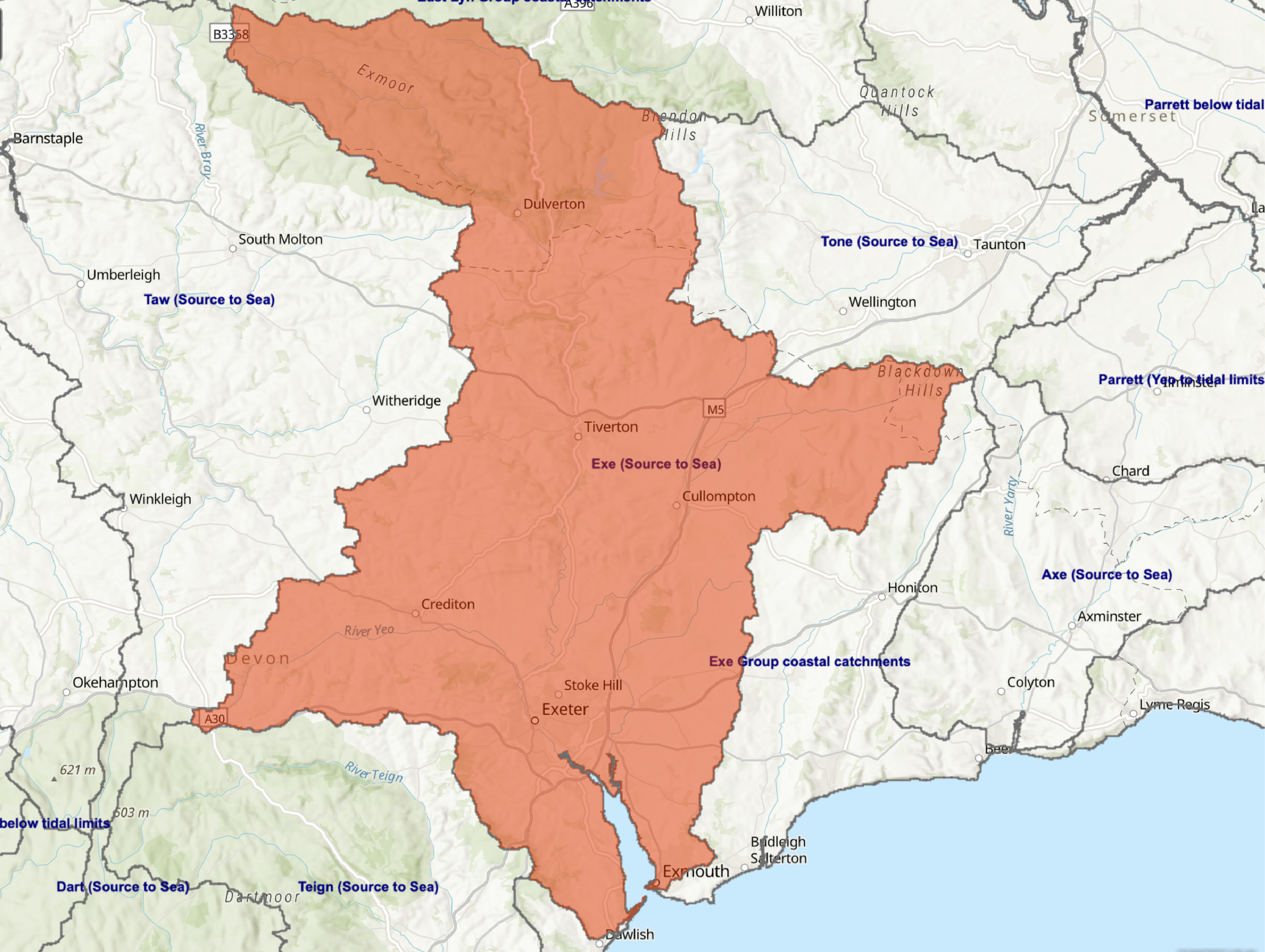
Figure 1. Downstream hydrological connection
Catchment diagram showing the sequence from Wildwood Grove to the Streamcombe tributary system, River Brockey, River Exe and Exe Estuary.
Downstream Connection
The hydrological connection from Wildwood Grove can be described as:
Wildwood Grove
Streamcombe tributary system
River Brockey
River Exe
Exe Estuary
English Channel
This sequence places Wildwood Grove at the upper end of the catchment system rather than within the lower river or estuarine environment.
Headwater Position
Wildwood Grove is a headwater site.
The site contains spring emergence, wet ground, ditches, tributary channels and a watercourse that contribute flow to the Streamcombe system.
Headwater areas form the first stage of river catchments. They collect rainfall, groundwater discharge and surface runoff before these waters combine into larger tributaries and main river channels.
At Wildwood Grove, this headwater role is expressed through the movement of water from springs and drainage pathways into the Streamcombe tributary system.
River Brockey Sub-Catchment
The Streamcombe tributary drains into the River Brockey.
The Brockey forms part of the upper River Exe catchment network and provides the intermediate connection between the Streamcombe headwaters and the River Exe.
Wildwood Grove is therefore not directly on the main River Exe, but contributes to it through the Streamcombe and Brockey system.
Wider River Exe Catchment
The River Exe catchment includes upland headwaters, agricultural valleys, tributary systems, urban areas, wastewater infrastructure, floodplain areas and the estuarine system downstream.
South West Water’s Exe Drainage and Wastewater Management Plan identifies the Exe catchment as containing 176 km of watercourses, including 114 km of Environment Agency designated Main River, and specifically includes the Brockey River within the Exe catchment watercourse network.
The wider catchment is subject to multiple water-management issues, including flood risk, water quality, diffuse agricultural pollution, wastewater pressures, physical modification and estuarine protection requirements.
The Exe Estuary Management Partnership identifies diffuse agricultural run-off, sewage discharges, physical modification, barriers to fish migration and urban diffuse sources as significant water-management issues within the River Exe catchment.
Agricultural Headwaters
The upper Exe catchment contains extensive rural and agricultural land.
Catchment Sensitive Farming information for the Headwaters of the Exe identifies raw water quality as a key priority and notes that agricultural inputs such as farmyard manure, artificial fertilisers, pesticides and veterinary medicines can enter watercourses and affect habitats and water quality.
Wildwood Grove sits within this wider agricultural headwater context as a small spring-fed holding within the upper catchment.
Exe Estuary
The River Exe ultimately discharges into the Exe Estuary between Exeter, Exmouth and Dawlish Warren.
The Exe Estuary supports a range of intertidal habitats including mudflats, sandflats, saltmarsh and coastal grazing marsh.
The estuary forms part of a series of nationally and internationally recognised environmental designations, including:
Exe Estuary Site of Special Scientific Interest, SSSI
Exe Estuary Special Protection Area, SPA
Exe Estuary Ramsar Site
These designations apply to the estuarine environment located at the downstream end of the River Exe catchment.
Water originating within upstream tributaries and headwater systems, including those within the River Brockey sub-catchment, ultimately flows towards this receiving environment.
Wildwood Grove Within the Catchment
Wildwood Grove occupies a small but defined position within the River Exe catchment.
It is located at the upstream end of the system, within the Streamcombe Valley and River Brockey sub-catchment. Water leaving the site becomes part of the wider Exe catchment network before ultimately reaching the Exe Estuary.
The site is therefore best understood as a headwater component of the River Exe catchment rather than as an isolated agricultural holding.
From catchment position to recognised pressure
Wildwood Grove is not an isolated holding. Water leaving the site enters the Streamcombe tributary system, then the River Brockey and River Exe.
The next step is to understand the recognised environmental pressure layers associated with this headwater position.