
Agricultural History
How has Wildwood Grove been managed historically?
Evidence Sources
The information presented on this page is derived from historic mapping, aerial photography, conveyance records, agricultural drainage records, field boundary evidence, site observations and available locality records.
Overview
Wildwood Grove forms part of a long-established agricultural landscape associated with Streamcombe, Three Gates Cross and Wilway.
The present-day site reflects successive periods of agricultural management, enclosure, access, drainage and land improvement. Historic mapping records established field boundaries, springs, access routes and agricultural land parcels. Later records show continued agricultural use, drainage engineering, farm ownership links and agricultural infrastructure.
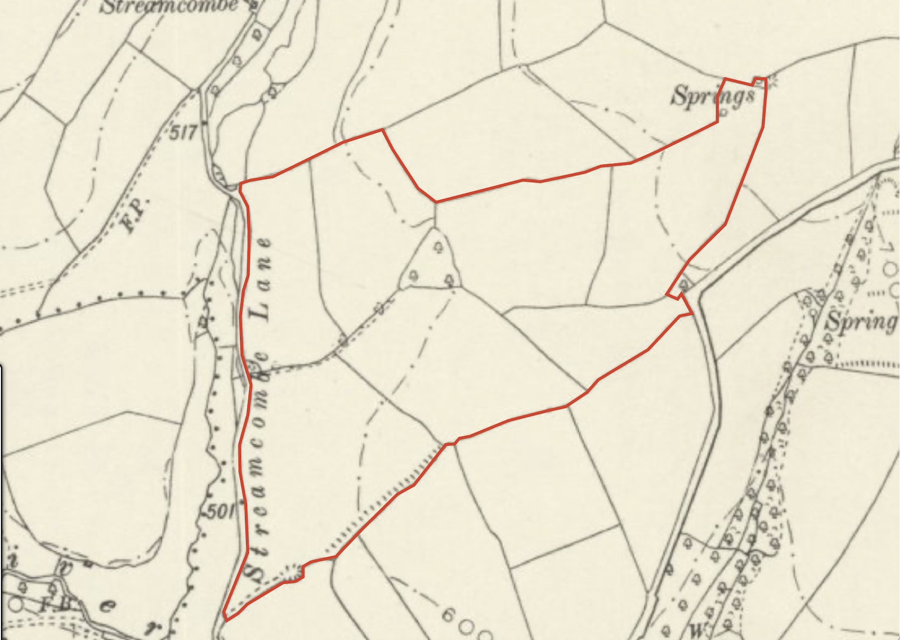
Figure 1. Historic agricultural landscape
Historic mapping showing field boundaries, lanes, springs, access routes and agricultural land parcels within and around the present holding.
Early Agricultural Landscape
Historic locality records indicate that the surrounding landscape was in agricultural use before modern mapping. By the time detailed mapping became available, the area already contained dispersed farmsteads, lanes, enclosed fields, watercourses and spring-fed valleys.
Nineteenth-Century Mapping
Early Ordnance Survey mapping records an already enclosed agricultural landscape.
The maps show established field boundaries, Streamcombe Lane, access routes, multiple springs, and agricultural land parcels within and around the present holding.
Several spring features are explicitly mapped, including “Spring” and “Springs” within the upper part of the site.
Field Pattern and Enclosure
Comparison between nineteenth-century mapping, twentieth-century aerial photography and the present-day holding shows continuity in the broad field pattern.
Some boundary changes occurred over time, but several historic field divisions remain legible in the modern landscape.
Historic Springs and Water Movement
Historic mapping records spring features in the eastern part of the site.
One mapped spring is shown emerging, spreading downslope and collecting into a defined flow path. This records spring-fed water movement before the later agricultural drainage scheme.
Agricultural Drainage and Land Improvement
A certified drainage scheme was implemented across parts of the holding in the twentieth century.
The drainage plan records collector drains, lateral field drains, pipe drainage infrastructure, outfalls, flow directions and multiple pipe diameters.
This drainage infrastructure forms part of the agricultural modification history of the site and remains relevant to the present physical landscape.
Agricultural Ownership and Management
Historic conveyance and sale records associate the land with the wider agricultural landscape of Streamcombe Farm and Wilway Farm.
The site has been managed as agricultural land within a wider system of fields, farm access, drainage, boundaries and agricultural buildings.
Present-Day Agricultural Landscape
Wildwood Grove remains a contemporary agricultural holding.
The present landscape contains evidence of historic field boundaries, mapped springs, agricultural drainage infrastructure, access routes, agricultural buildings and managed grassland.
The current physical system reflects the cumulative influence of agricultural management, land drainage, infrastructure development and natural hydrological processes.